 visitcorinthia.com
Corinth Canal: History, Visit and What to Expect
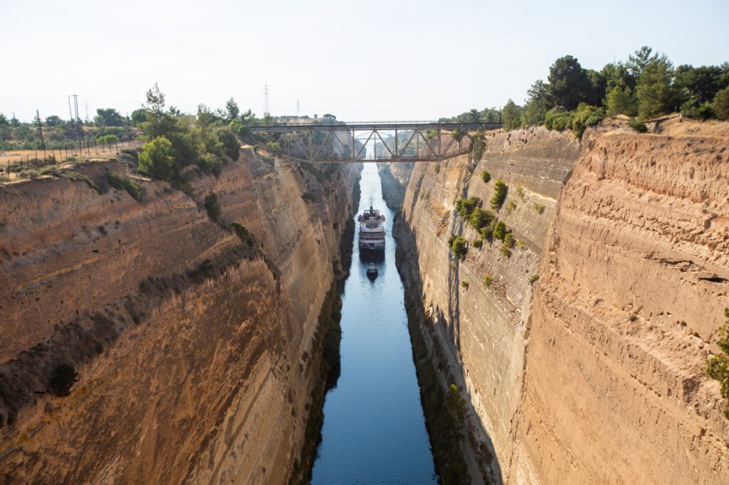
The Corinth Canal cuts through the 6.3-km Isthmus of Corinth, separating the Peloponnese from the Greek mainland and connecting the Corinthian Gulf to the Saronic. Built between 1881 and 1893, it is only 21.4 m wide — too narrow for most modern cargo ships, but still used by thousands of private yachts and tourist vessels each year.
History
The idea of a canal at the Isthmus of Corinth is at least 2,300 years old. Periander, tyrant of Corinth in the 7th century BC, reportedly planned one and abandoned the project. Julius Caesar considered it. Caligula sent engineers to survey it. Nero actually began excavation in 67 AD — with 6,000 Jewish prisoners — before his assassination ended the work. The modern canal was finally built between 1882 and 1893 by an international company using thousands of workers and the most advanced excavation technology of the 19th century.
The resulting cut is 6.3 km long, 21.3 m wide, and 8 m deep through solid limestone that rises 70–90 m above the water on either side. The walls are nearly vertical — the engineers couldn’t safely angle them back, so they went straight down through the rock. The visual effect, when you look down from the bridge, is unlike anything else built by human hands in the 19th century.
Visiting
The main road bridge crosses the canal on the old national road between Corinth and Athens, and stopping to walk across it is free. Stand at the railing and look down: 70 metres of air, then turquoise water between two walls of pale limestone. Ships in transit are visible from the bridge — mostly private yachts and small cargo vessels, since the channel is too narrow for modern commercial shipping. A passing yacht, seen from directly above, looks surprisingly small against the scale of the rock walls.
Near the canal, at the east end, a diving bridge (submersible road bridge) allows pedestrians to watch it sink into the water to let a vessel pass — an unusual mechanical spectacle that operates on a schedule tied to ship transits. Check with local tourist offices for timing.
The Diolkos
Before the canal, the ancient solution to the same problem was the Diolkos — a paved trackway along which ships were hauled overland on wooden rollers between one sea and the other, avoiding the dangerous rounding of Cape Malea. Remains of the Diolkos are visible on the western bank of the canal: 2,600-year-old grooves worn into the limestone slabs by the keels of passing ships. Few ancient engineering sites in Greece feel as immediate.
Boat Transit and Activities
Private yachts and charter boats can transit the canal for a fee, booked through the canal authority. The transit itself takes about an hour at slow speed. Bungee jumping from the old railway bridge (79-metre drop above the water) is available from a local operator seasonally. Kayaking through the canal is possible on guided trips when sea conditions allow. All three are operated by independent providers — check local listings for current availability and pricing.
Combining With Other Sights
The canal is 5 km east of Corinth city and 15 km east of Loutraki, making it a natural addition to any Corinthia itinerary. Combined with Ancient Corinth, Acrocorinth and the Diolkos ruins, the canal completes a half-day arc through two thousand years of Corinthian infrastructure — all within a 15-km radius.
Related articles
Scan to open the page with maps, photos and updates.
Printed on: 18/10/2026